
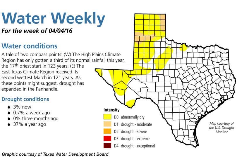
Texas has received above normal rainfall in March throughout most parts of the state. Historic flooding in East Texas gave the region its second wettest March in more than 120 years.
But it left some parts of the Panhandle and West Texas looking for more moisture.
The High Plains region has only received a third of its normal rainfall this year. Many areas in the Panhandle and Upper Rio Grande are suffering from dry conditions.
According to the Texas Water Development Board (TWDB)’s Water Weekly, 3 percent of the state is suffering from abnormally dry conditions.
The TWDB’s drought outlook shows drought conditions are expected to persist through April for the Panhandle region.
Severe weather may also be a threat for April due to the spring weather pattern and warmer temperatures that arrived ahead of schedule in mid-March throughout the Lone Star State.
“If we do get above normal rainfall, which is still needed for some, it does come at a price with some severe weather. So I think we’re going to be looking for a relatively active April,” Mark Fox, National Weather Service meteorologist, said in an interview with the Texas Farm Bureau Radio Network.
April temperatures should be average, according to Fox.
“Temperatures are showing to be right at normal or so. Not expecting a dip in temperatures or really anything way too above normal. We’ll have our swings as Aprils are famous for, but I think when it’s all said and done we’re going to come right at or close to average,” Fox said.
Fox said as we move out of the El Niño pattern and the early shut off of severe weather could mean summer will be warm and dry.