
By Jennifer Dorsett
Field Editor
Drones are often seen as fun to fly and useful for checking crops, but one young Texas Farm Bureau member is finding different and innovative ways to use drone technology one field at a time.
In high school, Matt Mahler started learning about consumer drones.
“Then, when I got into farming full-time around 2015, I got into more of the science side of business—the different crop stages, what people in the industry were using drones for,” Mahler, a Wichita County farmer, said. “I started looking into higher-end drones for personal use for camera quality—checking crops, counting cattle, that sort of thing. My personal use just jumpstarted the idea to help other producers around the state.”
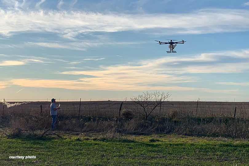
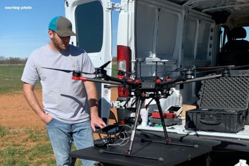
Now, in addition to being a full-time farmer, Mahler conducts drone-based aerial photography for farmers and ranchers in Texas and several other states. He specializes in multi-spectral and Light Detection and Ranging (LiDAR) photography.
“There was really nobody in our area doing drone work,” Mahler said. “So, in 2016, I went to a conference in Las Vegas called Interdrone, which helped me figure out what was available for the ag world. Then, through personal research and development, I built my business to what it is today.”
Multi-spectral photography involves mapping a crop field by taking a series of photographs, then running the digital files through a software program that will highlight areas where crops are stressed from drought. Mahler said the reflection of light rays gives an accurate snapshot of every area of a field.
“The results will reveal patterns where parts of the field could use more water, or we can look at weed pressure with these maps,” he said. “We’ve even been able to pinpoint equipment malfunctions like where planters equipped with fertilization equipment didn’t fertilize or didn’t sow seed. It’s very accurate and pretty neat to see.”
Some new sprayers can even be programmed to only spray in those areas, allowing a farmer to quickly and efficiently apply chemicals in a field, he added.
LiDAR is a type of laser measurement sensor in which Mahler flies drones across fields and pastures to get three-dimensional models of the land. The models can be used to build topographical maps with waterways and plan terraces in fields before construction ever starts.
“A lot of farmers are skeptical because the market is so small, and there aren’t a lot of people doing this kind of work. So, the farmers haven’t really seen the results yet,” he said. “But once they see what we can produce, it really opens their eyes, and they start thinking about other applications.”
The drone business keeps Mahler busy. He estimated about five days a week is spent doing drone work.
“I try to catch up on the farm on the weekends unless it’s planting or harvest season,” he said. “Then, I have to really hustle.”
There’s nothing else he’d rather do, though, than spend time on the land he loves while helping others achieve more out of their farms and ranches.
“The best part of my work is going to a farmer or rancher that’s been in the business a long time and seeing their skepticism of the technology, then doing a sample run and seeing the wheels start turning in their head,” Mahler said. “Just to watch that realization of how effective this technology can really be and breaking the technology barriers is very rewarding.”
Excellent piece. Proud of you