
By Jessica Domel
Multimedia Editor
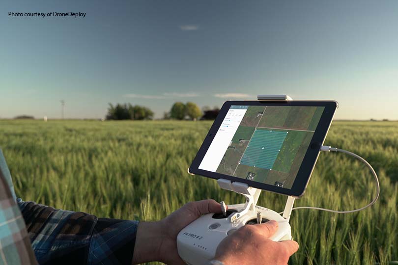
Drones are providing more to our lives than a faint hum, excitement and captivating images. The unmanned crafts are also a useful tool for farmers and ranchers across the globe who want to map their acreage, track crops and check on livestock.
According to a new report from DroneDeploy, a cloud-based platform for commercial drone use, agriculture is one of the top drone adoption leaders worldwide.
To meet the growing demands and usage, more agricultural companies are integrating drone technology and data into their systems.
Tuesday, DroneDeploy announced its connection with the John Deere Operations Center, which allows users to access their drone data same-day using a MyJohnDeere login.
“It allows me to take a look at the data that comes from drones and compare against application data, yield from combine and historical data. I can easily share this data with crop consultants and advisors and use it to make more informed decisions throughout the year,” Jeff Buyck, owner and operator of Buyck Farms in Balaton, Minn. and Integrated Solutions Manager at C & B Operations, said.
By integrating the data with the John Deere Operations Center, farmers can now import field boundaries for drone flight planning, capture, view and annotate maps and export maps and insights from DroneDeploy into their John Deere account.
Data analytics and automation technology, combined with drone mapping, could allow farmers to increase their efficiency and yields by helping them decide when and where it’s best to water, use pesticides and fertilizers.
Select Case IH machinery offers similar features through DroneDeploy as well.
To date, over 10 million acres have been mapped by DroneDeploy users in more than 160 countries.
According to the report, more than half–60 percent–of all commercial drone users utilize the technology once per week. That’s up 40 percent over last year.
That mapping has reportedly returned an estimated $150 million to economies worldwide.
The types of drones used are also changing. Now, about 97 percent of drone-mapping is completed with multi-rotor rather than fixed wing drones.
Although drones can carry a pretty hefty price tag, the majority of users aren’t paying for the most expensive models. About 84 percent of drone mapping is now done on models costing $1,500 or less.
The most popular drone brands are currently: DJI, SenseFly, 3DR, Parrot and Autel. The most popular cameras, according to the report, are DJI, Canon, Sony, GoPro and Flir.
Farmers and ranchers who don’t own a drone, but would like mapping drones, are likely to pay around $168 an hour this year. That’s up 16 percent.
The average hourly rate for general photos and video is slightly lower at $145.
The full report is available here.